|
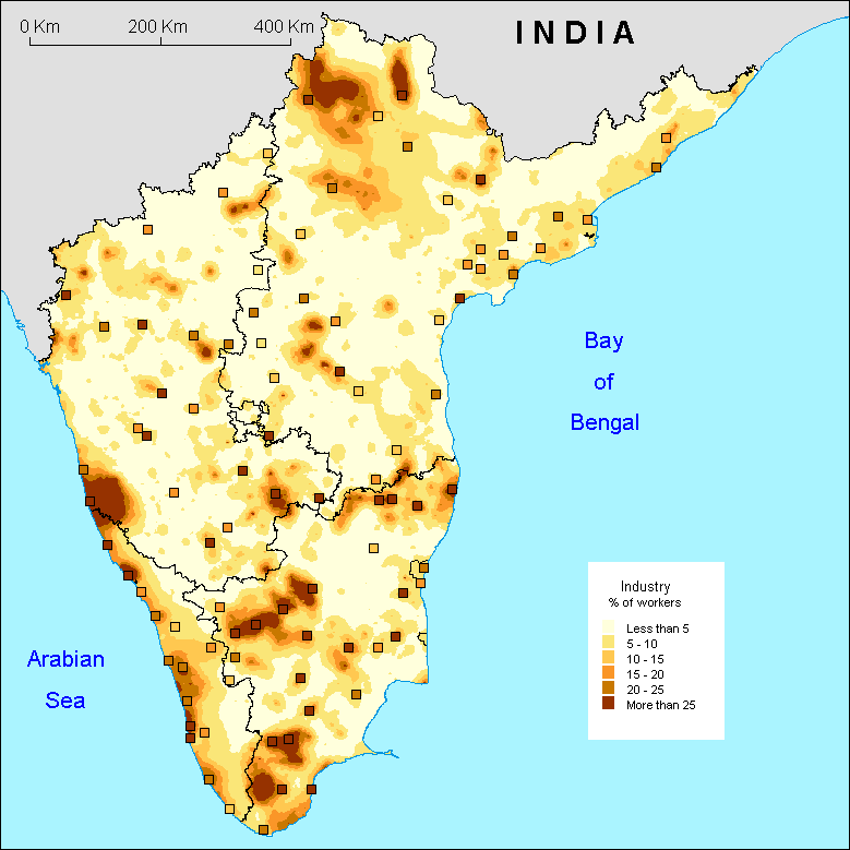
The first striking feature of the map of industrial activity in South India are the major contrasts and clusters of the distribution of workers of the secondary sector. Pockets where the ratio of these workers is above 25% border regions with a ratio of less than 5% . These local disparities are echoed at the level of the cities: they show a level of workers very different to that of their hinterland as opposed to what appeared in the service and agriculture maps.
In effect, the level of primary activity is always very low in the cities (generally less than 30%) and that of the tertiary activity too high to visualise the differences. Three patterns emerge:
Firstly, zones without industry, which are characterised by the presence of cities where the level of employment in the secondary sector is low and virtually nil in the rural area.
Secondly, isolated cities, where the industry is located within the city itself and little or less in the countryside.
And finally, the industrial regions, where the cities show a high level of secondary employees and are embedded in a rural fabric which is industrialised. Within this category, we find well known areas of the Indian industry, the region to the east of Nizamabad in northern Andhra and the Ramagundam-Asifabad corridor, Chennai and the Palar valey in Tamil Nadu, the Coimbatore plateau, the southern tip of Tamil Nadu (from Sivakasi to Nagercoil) and finally the keralite coast up to Mangalore.
S.O.
|