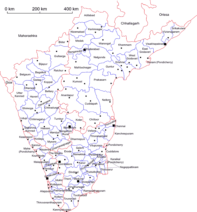
ATLAS OF SOUTH INDIA - 1991


Districts of South India


Theme State

Tenali Guntur Bhimavaram Gudivada Eluru Amaravathi Machilipatnam Chiral Ongole Rajamundry Kakinada Visakhapatnam Vizianagaram Chitoor Tirupati Hindupur Cuddapah Proddatur Anantapur Guntakal Adoni Nellore Mahbubnagar Warangal Khammam Warangal Karimnagar Ramagundam Hyderabad Nizambad BIjapur Shimoga Mangalore Hassan Udupi Davangere Kolar Bangalore Tumkur Chitradurga Mysore Mandya Hubli-Dharwad Gadag Hospet Bellary Belgaum Raichur Gulbarga Bidar Palakkad Thiruvananthapuram Quilon Kottayam Alappuzha Cherthala Cochin Thrissur Guruvayoor Malappuram Kozhikode Vadakara Kannur Kanhangad Erode Tiruppur Kumbakonam Thanjavur Karur Tiruchirappalli Salem Neyveli Cuddalore Pondicherry Arcot Tiruvannamalai Vellore Kanchipuram Chennai Coonoor Coimbatore Pollachi Valparai Dindigul Karaikudi Madurai Rajapalayam Sivakasi Tuticorin Tirunelveli Nagercoil Chikmangalur Kurnool Nandyal

This administrative map doesn't need a comment. Anyway, we want to draw the reader's attention to two points:

  1. The size, as well as the population of south Indian district are unequal. Comparing Kerala and Andhra Pradesh is enlightning. That's one of the reason, we decided to go for a village level mapping.
  2. The name, as well as the form are changing quite often in India. This map presents the district in 2001, that is after the last changes. That's the name we refer to in the map comments.

A bigger map is available by clicking here

S.O.

 
More about the mapping More about the data Back to the Main menu

© S.Oliveau 2003